Canoeists in California don’t generally have access to the
sort of trips that those in the upper Midwest do. We have no “Land of 10,000
Lakes”, no Algonquin or Boundary Waters or Quetico, and save for the Lower
Colorado no long lazy rivers through deep wilderness. I’ve long held a desire
for a multi-day trip that would take me through a number of lakes but that’s
pretty tough to find. Most lakes in California are either man-made water
storage reservoirs in the foothills around urban areas or in the low Sierras or
man-made reservoirs for power generation in the high Sierras. The latter has
provided a for a few of my trips in the past ( Hell Hole & Iron Canyon )
but given the terrain that they reside in most do not allow one to paddle a
lake, hoist your canoe onto your shoulders and hike a reasonable distance to
the next lake and repeat.
But there are a few exceptions if you look really high into
the Sierras. In areas where glacial forces long ago carved divots out of the
landscape that now hold runoff from winter snows. I’ve found a few chains of
these glacial lakes that I wanted to check out and when some unexpected time
off presented itself last year I jumped at the chance for a few days away from
the Valley, email, cellphones and noise.
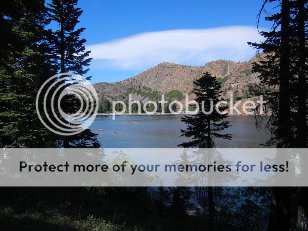
The ultimate destination was Culbertson Lake which sits at
about 6500’ in the Sierras. It’s about 8mi north of I-80 as the crow flies, but
closer to 20 by road….the last 5+ unpaved. The lake is accessible without a
4x4. I made it in/out in my little diesel Jetta Wagon, but I’d definitely
recommend something with more ground clearance. I managed to buggar a sensor on
my exhaust system clanging over the rocks.
Culbertson is accessed only one of two ways. You can hike in
about 7mi by dirt road, or there is a longer singletrack trail route that is
roughly ½-again that distance or you can, as I did, portage and paddle your way
through the chain of lakes downslope of Culbertson.
I parked my car for the weekend at Lower Lindsey Lake. There
is an “Iron Ranger” there to pay for a campsite at Lower Lindsey but no
indication as to whether you need to pay if you are merely parking there to
access the back country. I decided to play it safe and pay for two nights. Once
parked & paid, I unloaded the canoe and set off up the trail to Middle
Lindsey Lake. This portage is on a fire road. It’s a bit rocky in places and
loose in others so use care when carrying your canoe. The hike isn’t
particularly long but it does begin at ~6200’ and the day I did it, temperatures
were in the mid-90’s. I made two trips. The first with the canoe (50lbs) and
then I returned to the car for my pack (80lbs) and tackle box.
Once I arrived at Middle Lindsey Lake I loaded the canoe and
made a slow trip around the lake while looking for the spot where I’d pull out
for the next leg. This is a pretty small little lake and it sits at ~6400’. At
some point in the past PG&E built a small dam at the West end which roughly
doubled the surface area of the lake to roughly 1,700’x1,000’ but only
increased its depth by maybe 8’. It’s very shallow and very warm and as such
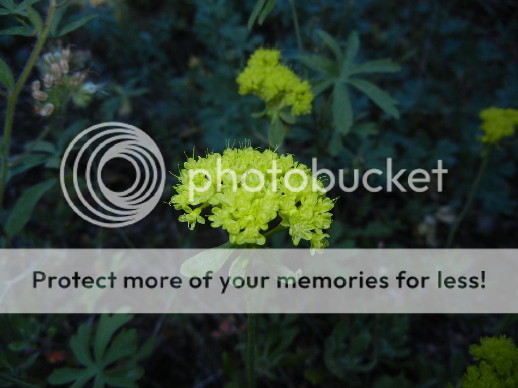
lacks the oxygen level to support trout. I did see some small bullhead in the shallows
though. While paddling around Middle Lindsey I also spotted a sizeable female Black
Bear and her cub on the Southern bank. More on that later…
I’d researched this trip a bit and found a description of
the route that made finding the portage landings easier. It seems that it has
been quite some time since anyone has made this trip though and the growth
around the landings was difficult to find if you don’t know which major
landmarks to look for.

The next leg of the portage, from Middle Lindsey to Upper
Lindsey is rather short but you climb, descend, then climb again through some
pretty rough and steep terrain. Upper Lindsey sits at 6500’, just 100’ higher
than the middle lake but the up-down-up portage means your carrying canoe &
pack 2-3x that figure. This portage wasn’t very clear and it took me a bit of
time to find the route. Again, two trips, but this time I took the pack first
as it’s far easier to scout out a route if your head isn’t inside a 16’ canoe.
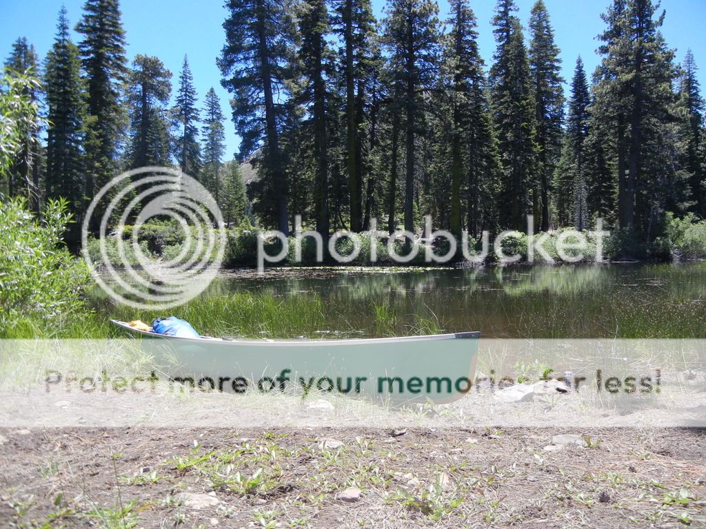
 |
| The bank where I spotted the female Black Bear and her cub |


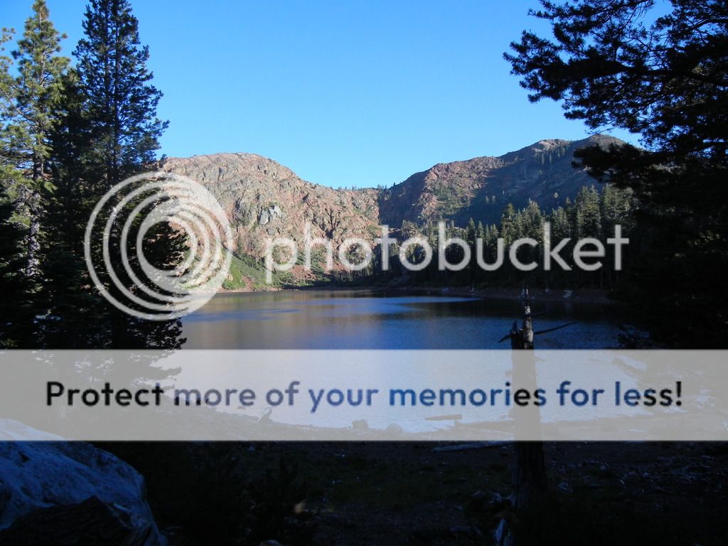
Upper Lindsey is a quite small glacial tarn. It’s only about
500’x300’ but there are some great looking spots to camp around it’s banks. It’s
a brief paddle across to the last portage up and over the ridge to Culbertson
Lake. This landing was very difficult to find due to the brush growth along the
bank. Eventually I found a gap that I was able to ram the canoe into and part
the brush enough to me to pull the canoe out. I spent a bit of time with my
knife cutting back the brush a bit, but by now that work is probably erased. If
I do this trip again I’ll definitely bring a pair of pruning shears and clear
out a proper landing.
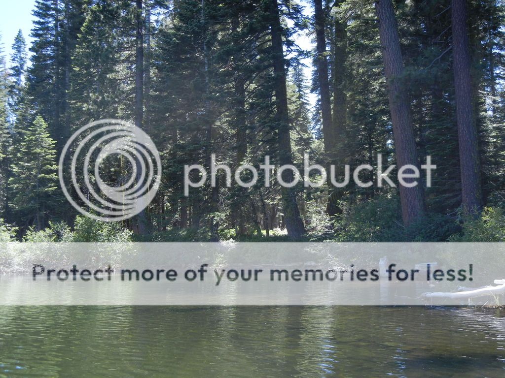
 |
| The "beach" I carved out of the brush on Upper Lindsey Lake |
Once I wrangled myself, my gear and the canoe through the
brush and onto the bank I set off over the ridge to Culbertson. This is the
shortest of the three portages but by no means easy. A number of large downed
trees cross the trail which makes carrying the canoe by yourself interesting to
say the least. The climb up onto the ridge isn’t particularly steep, but the
route does wind in/out of a few tight trees. Once the ridgeline is gained it’s
a short, but quite steep descent down to the bank of Culbertson lake at ~6500’.
I strongly recommend carrying your pack first to scout out a good route through
the trees and down to the bank and keep in mind, the steep descent down to the
lake on the way in is a steep climb on your way out.
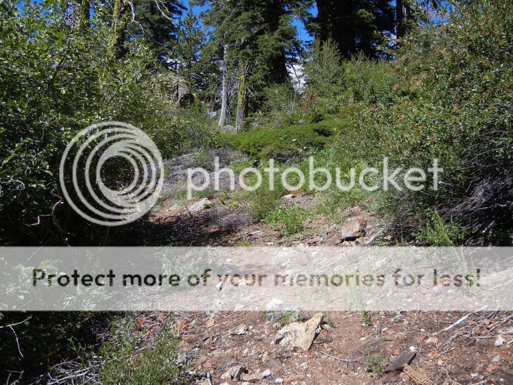 |
| The beginning of the portage to Culbertson, once you get in the woods ahead it gets tough |

I loaded the canoe again for the last time that day and set
off for the peninsula that juts out into the middle of the lake. My thinking
being that the extra exposure to the wind might reduce the mosquitoes. And it
did…until the wind died. All told it took me roughly 5hrs to paddle/portage my
way into Culbertson. It was hot & hard work, but as you’ll see in the
photos below, it was well worth it.

I set up my camp on the peninsula, had a bite to eat and
then hopped back in the canoe to explore the lake a bit while doing some
fishing. Tradition on my solo canoe trips dictates that there is an inverse
relationship between the researched quality of the fishing in a given lake and
my ability to take advantage of it. That tradition held out on this trip as
well. It is said that Culbertson is home to a healthy population of Brown and
Rainbow Trout. While I did catch one of each on my trip my performance as an
angler by no means lived up to the reports….as usual.


As the sun began to set I made my way back to my camp,
prepared my dinner ( Backpackers Pantry
Jerk Chicken & Rice…my favorite!), put my food bag up a tree and
found a suitable log on which to sit and watch the stars come out to play.
I’ll do a post in the future on the proper way to hang a
food bag because as it turned out, hanging my food bag was a good idea. For the
second time in my last three solo trips I had a bear visit to my camp in the
middle of the night. I don’t know if it was the same female and cub I’d seen
earlier in the day but a pair walked within 10’ of my tent in the night and
spent a good bit of time under my suspended food bag trying to get at it. I
never heard them though and they didn’t mess with me in the tent at all.
The next morning was gorgeous. I had a little breakfast and
hopped in the canoe for some more fishing…..or more accurately, beating the
surface of a lake into a froth, drowning worms and otherwise not catching fish.
Oh well, as they say, the worst day of fishing is better than the best day of
working right?
By 11am the wind kicked up and I headed back to camp. Walking
into my camp I was met by good sized Mule Deer buck (4x5) that had been feeding
near my tent. Unfortunately, my camera was in my tent not my pocket. Hopefully
I’ll see him or one of his cousins sometime around the end of October. I then had
some lunch and found a nice spot in the shade to spend the afternoon reading. I’m
not sure how long I’d been asleep in the shade with my book in my lap when I
was startled awake by the sound of an American Bald Eagle and an Osprey engaged
in a heated debate over the fishing rights to the part of the lake in front of
my camp. Apparently the Eagle came out on top as a pair returned later that
afternoon and each made off with a small Rainbow Trout…..while mocking me.


I took a quick swim in the lake before sunset and settled
down on my favorite log for dinner ( Mountain House Lasagna ). Due to the
drought in CA fire danger in the Sierras was exceptionally high. I figured that
discretion was the better part of valor and decided against a campfire on this
trip. The bonus was that without the firelight, the stars were even brighter. The view went spectacularly well with the
flask of Manhattans that I’d brought along. So slightly buzzed…ok, drunk, and
with the sound of nothing ringing in my ears I crawled back in the tent for the
last night.
In the morning I packed up and reversed the
paddle-portage-paddle routine. The return trip was a fair bit quicker as I didn’t
have to spend any time finding my way and it was blessedly mostly downhill.

I have a few other multi-lake trips identified that I’d like
to try this summer but with the minimal snowpack this year the lake levels may
be too low.
Haha....In 2011, I did this exact same trip only with a kayak. It was one of the few times I wished I had a machete :) Doing with a canoe, without a cart?? You sir are an animal.
ReplyDeleteMy rig at the gate (The cart was a former baby bike trailer)
http://s1204.photobucket.com/user/woodcreekguy/media/photo.jpg.html
You dont have to pay parking if you are not camping at lower lindsay. I've been going to this area for years without paying for parking.
You are really fortunate to see bears. I've never seen one even after 20+ over night trips in this area.
Great read and it sounds like you had a wonderful stay at Culbertson Lake. Do you have any idea what the surface acreage size the lake is?
ReplyDeleteI found out my answer...it is 70 surface acres at an elevation of 6,442 feet above sea level. Plan on visiting and hiking to this lake over the weekend. Just a note....the signs state that parking is not allowed at Lower Lindsay Campground without paying a fee.
Delete